 Leave the park...
Hike Description:
Leave the park visitor center, using the front entrance, and turn right on a dirt path, following the blue blazes of the Sterling Lake Loop. The trail briefly joins the paved entrance road, then bears right and goes across a grassy field, passing the stone foundations of a former church on the right. It enters the woods on a footpath and soon reaches a junction with the yellow-blazed Lakeville Ironworks Trail.
Turn left onto this trail, which passes the remains of the Sterling Furnace, built in 1770 and abandoned in 1804. The structure you see was rebuilt in the 1950s by the City Investing Company. After going across paved Old Forge Road, you'll pass an old house, a remnant of the Lakeville mining community, and cross a stream on a footbridge. The trail then crosses another paved road and climbs through a pine forest to an opening of the Sterling Mine, carved into the hillside. Iron ore was discovered in the area as early as 1736, and mining operations continued until 1923. The trail passes concrete-and-brick ruins of several buildings from the mining era and the opening of the Lake Mine (whose deep shaft extended under Sterling Lake), then descends to paved West Sterling Lake Road.
Turn left onto the road, once again following the blue blazes of the Sterling Lake Loop. The road now runs alongside Sterling Lake, affording views across the lake.
Soon, the road curves to the right. In another 200 feet, a sign marks the start of the Bare Rock and Fire Tower Connector Trails. Turn left, leaving the blue-blazed trail, then immediately turn right and continue along the orange-blazed Bare Rock Trail, which crosses a stream on a footbridge and climbs on an old woods road. The trail generally follows this road up the Sterling Ridge, but it has been routed off the road in several places to avoid wet and badly eroded sections. Follow the orange blazes for about three-quarters of a mile, climbing steadily, until you reach the crest of the ridge at a junction (marked by a sign) with the blue-on-white-blazed Sterling Ridge Trail and teal-diamond-blazed Highlands Trail.
Continue ahead on the Bare Rock Trail, which levels off, then narrows to a footpath and descends to cross a stream and reach the green-blazed West Valley Trail, a woods road. Bear left and continue to follow the orange blazes along this road. In a quarter mile, follow the orange blazes as they turn right and head west, descending on an old woods road. Soon, the trail turns left and briefly parallels a stream. After again turning left and crossing the stream on rocks, the trail climbs to the top of the ridge. Here, it reaches a junction marked by a sign “Bare Rock Vista.”
Turn right and descend rather steeply on a side trail, marked with binocular-logo-on-orange blazes. You’ll emerge onto Bare Rock – a spectacular viewpoint over Greenwood Lake. From this vantage point, you can see the entire six-mile-long lake, with Bellvale Mountain - the route of the Appalachian Trail - in the background. You'll want to take a break here to enjoy the panoramic view.
When you're ready to continue, climb back to the main trail and turn right. The Bare Rock Trail heads south along the ridge, with views of the lake through the trees. It bears left and descends into a valley, then climbs on switchbacks and continues to head south along a slightly higher ridge.
In a third of mile, the Bare Rock Trail bears left and crosses the ridge to reach an east-facing viewpoint, with the Sterling Forest Fire Tower visible directly ahead. You’ll soon be climbing this tower! From the viewpoint, the trail bears right and continues to descend. After crossing an intermittent stream in a hollow, the trail climbs to a large open rock ledge and passes some interesting boulders. It crosses another intermittent stream, descends through a hemlock grove, and ends at a at a woods road – the route of the white-stripe-on-red-blazed Fire Tower Trail and the green-blazed West Valley Trail.
Turn left onto the woods road, following the white-stripe-on-red and green blazes. In a quarter of a mile,  where the two trails diverge, bear right to follow the white-stripe-on-red-blazed Fire Tower Trail. The former route of this trail (a woods road) has been flooded by a beaver dam (visible just ahead), and the trail has been rerouted to a footpath south of the flooded area. Soon, the trail bears left, crosses a stream on rocks, skirts the flooded area, and rejoins the woods road.
Follow the road for half a mile to a junction with the blue-on-white-blazed Sterling Ridge Trail and the teal-diamond-blazed Highlands Trail. Turn left, now following three trails – the Fire Tower Trail, the Sterling Ridge Trail and the Highlands Trail.
After a short level stretch, the trail turns sharply right and climbs very steeply over rock ledges to reach a south-facing viewpoint from open rocks amid pitch pines. This is another good place to stop and take a break. The trail now descends to cross an intermittent stream on rocks, then climbs again – with two steep climbs interrupted by a short level stretch. At the top of the second climb, it reaches another, more limited south-facing viewpoint. The trail then levels off and soon reaches the Sterling Forest Fire Tower.
 Built in 1922, the fire tower affords an impressive 360° view of Sterling Forest and the surrounding area. Sterling Lake is in the foreground to the northeast, Cedar Pond may be seen to the south, and a portion of Greenwood Lake is visible to the west. On a clear day, North and South Beacon mountains of the East Hudson Highlands may be seen in the distance to the northeast, and Schunemunk Mountain is visible to the north, with the Catskills on the horizon.
When you're ready to continue, proceed east on the white-stripe-on-red-blazed Fire Tower Trail, which descends steadily from the ridge on a woods road (used by vehicles to access the fire tower). After about a mile, where the road levels off, you'll come to a junction. The Fire Tower Trail turns off to the right on a branch road, but you should continue ahead on the main road, now marked with red-triangle-on-white blazes as the Fire Tower Connector Trail. The road continues to descend, and after passing a private residence and going around a locked gate, it ends at a junction with the blue-blazed Sterling Lake Loop, near the shore of Sterling Lake. Turn right and follow the blue blazes back to the visitor center, where the hike began (note the left turn off the paved road in about a third of a mile).
Publication: Submitted by Daniel Chazin on 08/19/2010 updated/verified on 04/26/2015

This loop hike passes ruins of former mining activity and climbs to Bare Rock, with panoramic views over Greenwood Lake.
41.1989, -74.25684
Orange Co., NY
8 mi
5 hrs

Buy Map: Sterling Forest Trails Map
Avenza App Map: Sterling Forest 100
Hike Checklist:
Whether you are going for a day hike or backpacking overnight, it is good practice to carry what we call The Hiking Essentials. These essentials will help you enjoy your outing more and will provide basic safety gear if needed. There may also be more essentials, depending on the season and your needs.
The Essentials
Hiking Shoes or Boots
Water - Two quarts per person is recommended in every season. Keep in mind that fluid loss is heightened in winter as well as summer. Don't put yourself in the position of having to end your hike early because you have run out of water.
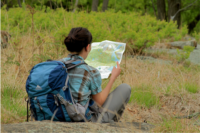
Map - Know where you are and where you are going. Many of our hiking areas feature interconnecting network of trails. Use a waterproof/tear-resistant Tyvek Trail Conference map if available or enclose your map in a Ziplock plastic bag. If you have a mobile device, download Avenza’s free PDF Maps app and grab some GPS-enhanced Trail Conference maps (a backup Tyvek or paper version of the map is good to have just in case your batteries die or you don't have service). Check out some map-reading basics here.
Food - Snacks/lunch will keep you going as you burn energy walking or climbing. Nuts, seeds, and chocolate are favorites on the trail.
Sunscreen and insect repellent
Rain Gear and Extra Clothing - Rain happens. So does cold. Be prepared for changing weather. Avoid cotton--it traps water against your skin and is slow to dry. If you are wearing wet cotton and must return to your starting point, you risk getting chills that may lead to a dangerous hypothermia. Choose synthetic shirts, sweaters and/or vests and dress in layers for easy on and off.
Compass - A simple compass is all you need to orient you and your map to magnetic north.
Light - A flashlight or small, lightweight headlamp will be welcome gear if you find yourself still on the trail when darkness falls. Check the batteries before you start out and have extras in your pack.
First Aid Kit - Keep it simple, compact, and weatherproof. Know how to use the basic components.
Firestarter and Matches - In an emergency, you may need to keep yourself or someone else warm until help arrives. A firestarter (this could be as simple as leftover birthday candles that are kept inside a waterproof container) and matches (again, make sure to keep them in a waterproof container) could save a life.
Knife or Multi-tool - You may need to cut a piece of moleskin to put over a blister, repair a piece of broken equipment, or solve some other unexpected problem.
Emergency Numbers - Know the emergency numbers for the area you're going to and realize that in many locations--especially mountainous ones, your phone will not get reception.
Common Sense - Pay attention to your environment, your energy, and the condition of your companions. Has the weather turned rainy? Is daylight fading? Did you drink all your water? Did your companion fail to bring rain gear? Are you getting tired? Keep in mind that until you turn around you are (typically) only half-way to completing your hike--you must still get back to where you started from! (Exceptions are loop hikes.)
Check the weather forecast before you head out. Know the rules and regulations of the area.
The Leave No Trace Seven Principles
Plan Ahead and Prepare
- Know the regulations and special concerns for the area you'll visit.
- Prepare for extreme weather, hazards, and emergencies.
- Schedule your trip to avoid times of high use.
- Visit in small groups when possible. Consider splitting larger groups into smaller groups.
- Repackage food to minimize waste.
- Use a map and compass to eliminate the use of marking paint, rock cairns or flagging.
Travel and Camp on Durable Surfaces
- Durable surfaces include established trails and campsites, rock, gravel, dry grasses or snow.
- Protect riparian areas by camping at least 200 feet from lakes and streams.
- Good campsites are found, not made. Altering a site is not necessary.
- In popular areas:
- Concentrate use on existing trails and campsites.
- Walk single file in the middle of the trail, even when wet or muddy.
- Keep campsites small. Focus activity in areas where vegetation is absent.
- In pristine areas:
- Disperse use to prevent the creation of campsites and trails.
- Avoid places where impacts are just beginning.
- Pack it in, pack it out. Inspect your campsite and rest areas for trash or spilled foods. Pack out all trash, leftover food and litter.
- Deposit solid human waste in catholes dug 6 to 8 inches deep, at least 200 feet from water, camp and trails. Cover and disguise the cathole when finished.
- Pack out toilet paper and hygiene products.
- To wash yourself or your dishes, carry water 200 feet away from streams or lakes and use small amounts of biodegradable soap. Scatter strained dishwater.
- Preserve the past: examine, but do not touch cultural or historic structures and artifacts.
- Leave rocks, plants and other natural objects as you find them.
- Avoid introducing or transporting non-native species.
- Do not build structures, furniture, or dig trenches.
- Campfires can cause lasting impacts to the backcountry. Use a lightweight stove for cooking and enjoy a candle lantern for light.
- Where fires are permitted, use established fire rings, fire pans, or mound fires.
- Keep fires small. Only use sticks from the ground that can be broken by hand.
- Burn all wood and coals to ash, put out campfires completely, then scatter cool ashes.
- Observe wildlife from a distance. Do not follow or approach them.
- Never feed animals. Feeding wildlife damages their health, alters natural behaviors, and exposes them to predators and other dangers.
- Protect wildlife and your food by storing rations and trash securely.
- Control pets at all times, or leave them at home.
- Avoid wildlife during sensitive times: mating, nesting, raising young, or winter.
Be Considerate of Other Visitors
- Respect other visitors and protect the quality of their experience.
- Be courteous. Yield to other users on the trail.
- Step to the downhill side of the trail when encountering pack stock.
- Take breaks and camp away from trails and other visitors.
- Let nature's sounds prevail. Avoid loud voices and noises.
The Trail Conference is a 2015 Leave No Trace partner.
(c) Leave No Trace Center for Outdoor Ethics: www.LNT.org.
Directions to Trailhead :
Take the New York Thruway to Exit 15A. Turn left at the bottom of the ramp onto Route 17 and head north for 1.4 miles to the exit for Sterling Forest. Follow Sterling Mine Road (County Route 72) west for 3.0 miles, then turn right onto Long Meadow Road (County Route 84). Proceed north on Long Meadow Road for 3.5 miles, then turn left onto Old Forge Road and continue for 0.5 mile until you reach the Sterling Forest State Park Visitor Center. Park in the parking lot on the right side of the road, then cross the road to the visitor center, where there are informative exhibits.
TRAIN TRANSPORT :
Not availableBUS TRANSPORT :
Not availableShare Your Experience
SUPPORT
 Support the trails with a donation!
Trail Conference volunteers maintain trails in this hike.
Trip Reports
rate experience October 09, 2014
very nice, with varied terrain
<p>The hike starts out on a paved road, goes through some historic sites, and then gradually gains some elevation with some rolling hills in some lovely glades and forest clearings. I like this hike because near the end is the nice steep hill climb up to the fire tower. Did this hike end of September and the leaves on the trees were just magnificent. This is a good hike to start out with for those who want to step up and add some mileage to their hikes, without all that elevation gain. What I like also is that the trails are extremely well marked, probably one of the best maintained trail circuits in the whole NY/NJ area. </p>
June 17, 2014
Mileage Correction
<p>Just did this hike with my hiking club on Sunday and both GPSs calculated the mileage to be 8.5 miles. You may want to revise your description. It's a great hike--wonderful views at Bare Rock and of course from the tower. </p>
June 09, 2012
a couple of minor things
<p>I did this hike today and had a great time. Just wanted to make a couple of notes to the description - the trail out to bare rock is now blazed orange with binoculars on the blaze and says Bare Rock Vista - you can't miss it. Also, in the flooded area near the beaver pond the fire tower trail is completely re-routed around it. I saw some pink ribbons from the past and to me it looks like it has been rerouted totally around, so no bush whack was necessary.</p>
<p>Last thing I would say, and just mu opinion, I would rate this as a moderate to streneous. The first two thirds are moderate - only the last part prior to getting to the fire tower would be strenuous. Before that there are a couple of little climbs but nothing too major.</p>
<p>Thanks for a good hike description. Had a great day. I had never been to Sterling - it was nice to see Greenwood Lake from the other side.</p>