This 1,700-acre preserve is the largest nature preserve in southwestern Connecticut. The system used to blaze the trails in the preserve differs from standard Trail Conference practice in that the color of the blaze designates only a category of trail use and does not distinguish one trail from another. Red-blazed trails are for hiking and cross-country skiing; yellow-blazed trails are hiking-...
Hike Description:
This 1,700-acre preserve is the largest nature preserve in southwestern Connecticut. The system used to blaze the trails in the preserve differs from standard Trail Conference practice in that the color of the blaze designates only a category of trail use and does not distinguish one trail from another. Red-blazed trails are for hiking and cross-country skiing; yellow-blazed trails are hiking-only; and white blazes indicate that the trail is part of the Saugatuck Valley trail system. Each trail junction is marked with a signpost that gives the number of the intersection and corresponds to the numbers shown on the map.
From the northeastern corner of the parking area, at junction 21, head east on the Laurel Trail, an old woods road, with red and white blazes. At junction 22, bear right and continue ahead on the Laurel Trail. Just beyond, at junction 23, a yellow-blazed trail begins on the left, but you should continue ahead, following the red and white blazes. The trail descends, crosses a wooden bridge over a stream, then turns sharply left at junction 31.
At junction 32, a side trail on the left leads down to the site of an historic sawmill. After making this short side trip, return to the main trail and turn left. Just ahead, bear left at the fork, then turn left and follow a footpath across the stone dam of Godfrey Pond – a mill pond built in the 1700s. Almost immediately, you’ll reach junction 25, where you should turn right onto a yellow-blazed trail.
Soon, you’ll reach the shore of the pond at another stone dam and spillway. A bench has been placed here, and you may wish to pause and enjoy the view. The trail bears left and descends to junction 26. Turn right here and cross the outlet of the pond on rocks and a wooden footbridge. Continue to follow the yellow blazes as the trail passes between cliffs and reaches junction 27, where you continue ahead, with the pond below on the right.
After crossing an inlet of the pond on a wooden footbridge (with cascades in the stream to your left), you’ll reach junction 30. Bear right, cross another inlet on a footbridge, and continue to follow the blazes around the shore of the pond. When you reach a woods road at junction 34, turn left onto the road, now following red and white blazes.
Soon, you’ll come to a fork at junction 35. Bear left here and begin to follow the Godfrey Trail, a woods road marked with red and white blazes. You’ll be following this trail for the next two miles. In a short distance, after crossing a stream on rocks, you’ll reach junction 36, where a side trail that leads back to the pond begins on the left, but you should continue ahead, following the red and white blazes..
In about a mile, you’ll arrive at the Portable Sawmill site, with an interpretive sign and rusted remnants of  machinery from the sawmill that operated at this location from the late 1800s until 1922. The trail now climbs to signpost 39, where you should bear right and continue to follow the red-and-white-blazed Godfrey Trail.
In another half mile, you’ll reach junction 64, where you continue ahead, now following the Pillars Trail. After crossing a footbridge, you’ll come to junction 63. Here, you should turn left, leaving the Pillars Trail, and begin to follow the Dayton Trail, marked with yellow and white blazes. (Note that yellow blazes are also used in this area to mark the boundary of the preserve. Take care to follow the trail, which has a well-defined footpath.) The trail goes by a cliff and climbs to junction 58. The Deer Run Trail, which begins on the left, will be your return route, but for now, bear right.
Almost immediately, you’ll reach junction 56. Turn right here and continue on the Great Ledge Trail. Soon, you’ll arrive at a rock ledge with a view through the trees of the forest below. This is the first broad viewpoint you’ll encounter on the hike. Just beyond, another rock ledge to the right of the trail offers a less obstructed view of the same forest. You might want to pause here to take in the view, but a more spectacular viewpoint is just ahead.
After descending a little, you’ll pass on the left a small monument (painted yellow) with the letters “W” and “R” (signifying the boundary between the towns of Weston and Redding) and reach junction 59. Continue straight ahead. When you come to junction 60, turn right, now following only white blazes.
In a short distance, you’ll come out on a rock ledge with a panoramic view over the Saugatuck Reservoir. Continue ahead on the white trail, and you’ll soon reach yet another viewpoint (from a rock ledge on the right), with an even broader view of the reservoir. This is the “real” Great Ledge, and you’ll want to take a break here and enjoy the view.
The trail now descends rather steeply for a short distance, then continues ahead and soon reaches junction 62. Continue ahead, and almost immediately you’ll reach junction 83. Turn left here, now following yellow blazes, and in a short distance pass through a gap in a stone wall and reach junction 61. Turn left, now following yellow and white blazes, and you’ll soon arrive at junction 59. You may recall this location, as you were here previously. Turn right and retrace your steps to junction 56 and, just beyond, junction 58.
Turn right at junction 58 onto the yellow-blazed Deer Run Trail. When you reach junction 55, turn left to continue on the Deer Run Trail, now blazed red, which descends steadily through mountain laurel thickets. After crossing a stream, the trail ascends gradually to junction 54. Turn right and begin to follow the Bedford Trail, a wide woods road that is also blazed red (with some old white blazes).
You’ll pass junction 52, where the Moller Trail begins on the right. In another mile, you’ll reach junction 49, where the Donahue Trail begins on the right and the road changes its name to the Den Trail (although this is not indicated by a sign). In each case, continue ahead on the woods road, marked with red blazes. The Ambler Gorge Trail goes off to the right at junction 44 (with a large wooden sign on the right), but you should continue ahead on the main woods road, which descends steadily.
After crossing a footbridge over a stream, you’ll reach junction 10. Here, you should bear left and continue to follow the wide road, which is now known as the Pent Trail. You’ll recross the stream on a wooden bridge and proceed ahead on the road, passing junctions 9, 8 and 7. Note that, between junctions 7 and 6, the trail is blazed yellow. The map shows this section of the road as a thin line, but that is because the road descends very steeply at this point and is therefore not suitable for cross-country skiing. The McDougal Trail (West and East), shown on the map with thicker lines, is actually a narrower route.
Continue to follow the road past junctions 6, 19, 5, 4 and 3 until you reach the parking area where the hike began.
Publication: Submitted by Daniel Chazin on 12/08/2011 updated/verified on 04/14/2019

This loop hike goes by a scenic pond and the ruins of an historic portable sawmill and reaches a viewpoint over a nearby reservoir.
41.236938, -73.395813
Fairfield Co., CT
7 mi
4.5 hrs

Web Map: Devil's Den Preserve Trail Map
Hike Checklist:
Whether you are going for a day hike or backpacking overnight, it is good practice to carry what we call The Hiking Essentials. These essentials will help you enjoy your outing more and will provide basic safety gear if needed. There may also be more essentials, depending on the season and your needs.
The Essentials
Hiking Shoes or Boots
Water - Two quarts per person is recommended in every season. Keep in mind that fluid loss is heightened in winter as well as summer. Don't put yourself in the position of having to end your hike early because you have run out of water.
Map - Know where you are and where you are going. Many of our hiking areas feature interconnecting network of trails. Use a waterproof/tear-resistant Tyvek Trail Conference map if available or enclose your map in a Ziplock plastic bag. If you have a mobile device, download Avenza’s free PDF Maps app and grab some GPS-enhanced Trail Conference maps (a backup Tyvek or paper version of the map is good to have just in case your batteries die or you don't have service). Check out some map-reading basics here.
Food - Snacks/lunch will keep you going as you burn energy walking or climbing. Nuts, seeds, and chocolate are favorites on the trail.
Sunscreen and insect repellent
Rain Gear and Extra Clothing - Rain happens. So does cold. Be prepared for changing weather. Avoid cotton--it traps water against your skin and is slow to dry. If you are wearing wet cotton and must return to your starting point, you risk getting chills that may lead to a dangerous hypothermia. Choose synthetic shirts, sweaters and/or vests and dress in layers for easy on and off.
Compass - A simple compass is all you need to orient you and your map to magnetic north.
Light - A flashlight or small, lightweight headlamp will be welcome gear if you find yourself still on the trail when darkness falls. Check the batteries before you start out and have extras in your pack.
First Aid Kit - Keep it simple, compact, and weatherproof. Know how to use the basic components.
Firestarter and Matches - In an emergency, you may need to keep yourself or someone else warm until help arrives. A firestarter (this could be as simple as leftover birthday candles that are kept inside a waterproof container) and matches (again, make sure to keep them in a waterproof container) could save a life.
Knife or Multi-tool - You may need to cut a piece of moleskin to put over a blister, repair a piece of broken equipment, or solve some other unexpected problem.
Emergency Numbers - Know the emergency numbers for the area you're going to and realize that in many locations--especially mountainous ones, your phone will not get reception.
Common Sense - Pay attention to your environment, your energy, and the condition of your companions. Has the weather turned rainy? Is daylight fading? Did you drink all your water? Did your companion fail to bring rain gear? Are you getting tired? Keep in mind that until you turn around you are (typically) only half-way to completing your hike--you must still get back to where you started from! (Exceptions are loop hikes.)
Check the weather forecast before you head out. Know the rules and regulations of the area.
The Leave No Trace Seven Principles
Plan Ahead and Prepare
- Know the regulations and special concerns for the area you'll visit.
- Prepare for extreme weather, hazards, and emergencies.
- Schedule your trip to avoid times of high use.
- Visit in small groups when possible. Consider splitting larger groups into smaller groups.
- Repackage food to minimize waste.
- Use a map and compass to eliminate the use of marking paint, rock cairns or flagging.
Travel and Camp on Durable Surfaces
- Durable surfaces include established trails and campsites, rock, gravel, dry grasses or snow.
- Protect riparian areas by camping at least 200 feet from lakes and streams.
- Good campsites are found, not made. Altering a site is not necessary.
- In popular areas:
- Concentrate use on existing trails and campsites.
- Walk single file in the middle of the trail, even when wet or muddy.
- Keep campsites small. Focus activity in areas where vegetation is absent.
- In pristine areas:
- Disperse use to prevent the creation of campsites and trails.
- Avoid places where impacts are just beginning.
- Pack it in, pack it out. Inspect your campsite and rest areas for trash or spilled foods. Pack out all trash, leftover food and litter.
- Deposit solid human waste in catholes dug 6 to 8 inches deep, at least 200 feet from water, camp and trails. Cover and disguise the cathole when finished.
- Pack out toilet paper and hygiene products.
- To wash yourself or your dishes, carry water 200 feet away from streams or lakes and use small amounts of biodegradable soap. Scatter strained dishwater.
- Preserve the past: examine, but do not touch cultural or historic structures and artifacts.
- Leave rocks, plants and other natural objects as you find them.
- Avoid introducing or transporting non-native species.
- Do not build structures, furniture, or dig trenches.
- Campfires can cause lasting impacts to the backcountry. Use a lightweight stove for cooking and enjoy a candle lantern for light.
- Where fires are permitted, use established fire rings, fire pans, or mound fires.
- Keep fires small. Only use sticks from the ground that can be broken by hand.
- Burn all wood and coals to ash, put out campfires completely, then scatter cool ashes.
- Observe wildlife from a distance. Do not follow or approach them.
- Never feed animals. Feeding wildlife damages their health, alters natural behaviors, and exposes them to predators and other dangers.
- Protect wildlife and your food by storing rations and trash securely.
- Control pets at all times, or leave them at home.
- Avoid wildlife during sensitive times: mating, nesting, raising young, or winter.
Be Considerate of Other Visitors
- Respect other visitors and protect the quality of their experience.
- Be courteous. Yield to other users on the trail.
- Step to the downhill side of the trail when encountering pack stock.
- Take breaks and camp away from trails and other visitors.
- Let nature's sounds prevail. Avoid loud voices and noises.
The Trail Conference is a 2015 Leave No Trace partner.
(c) Leave No Trace Center for Outdoor Ethics: www.LNT.org.
Directions to Trailhead :
From the George Washington Bridge, take I-95 to the Major Deegan Expressway north, which becomes the New York State Thruway. Take Exit 4, proceed east on the Cross County Parkway, and continue on the Hutchinson River Parkway north. Beyond the intersection with I-287, where I-684 begins to the left, bear right to continue on the Hutchinson River Parkway. The parkway crosses into Connecticut, where it becomes the Merritt Parkway (CT 15). Take Exit 42 (Westport/Weston) and turn right at the end of the ramp onto CT 57. Proceed north on CT 57 for 3.8 miles, then turn left to continue on CT 57 (as CT 53 proceeds straight ahead). Just beyond, follow CT 57 as it curves sharply to the right. In another 1.3 miles (beyond the sharp curve in the road), turn right onto Godfrey Road and proceed for 0.6 mile to Pent Road. Turn sharply left onto Pent Road and continue to the end of the road, where there is a parking area for the Devil’s Den Preserve.
TRAIN TRANSPORT :
Not availableBUS TRANSPORT :
Not available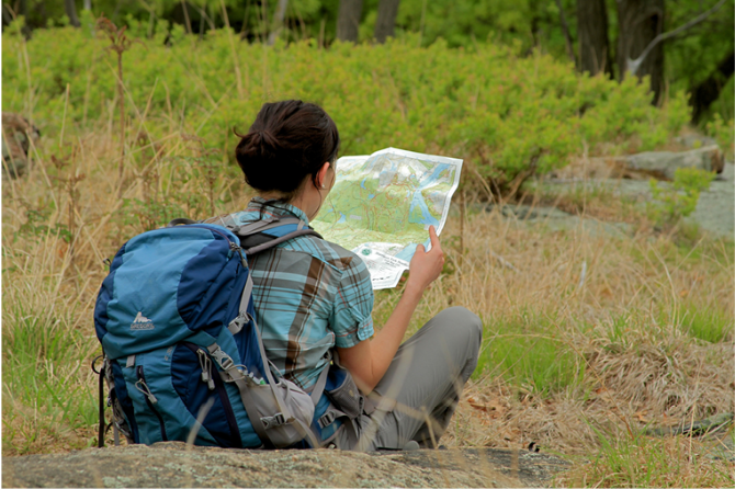
 Support the trails with a donation!
Trip Reports
rate experience September 25, 2022
Poor Views, But Great Trails
I did this hike on 9-25-22, with a few variations. Please note that as of this writing, the Wiehl Trail between junctions 14 and 15 is closed. I followed the Laurel Trail all the way to the Godfrey Trail, then followed the hike as written until junction 44 where i took the Ambler Trail through the gorge and down to junction 12. There are no views despite a couple spots on the map being listed as "vistas", but the trek through the gorge makes this trail worth doing. At junction 9 i took the Sap Brook Trail north, then at junction 38 I took the Hillebend Trail south. There's another "vista" listed on the map here, but again no views. Some cool rock formations though. I then took the Deer Knoll trail south and then back on the woods road to the parking area. I found the "Great Ledge" to be a disappointing view, as it was very obscured by trees. Perhaps it is a better view when the leaves are down. Having said that, the trails here are beautifully maintained, well-marked, and easy to follow. Most of the junctions have the junction number on a wooden post and signs with the trail names on them. My hike took me about 5 hours and i could go back and hike the same amount without redoing any of the trails i did today, so there are lots of trails to explore here.